Sign up here for FREE periodic updates from the Tamar Valley National Landscape, packed with the latest news, events, volunteering opportunities, and project updates. Simply add your name and email address below and your seasonal ebulletin will be emailed to you.
The Tamara Coast to Coast Way
Frequently Asked Questions
Please have a look at the information provided.
If you still have a question, or come across an issue on the path, please contact us below.
Contact us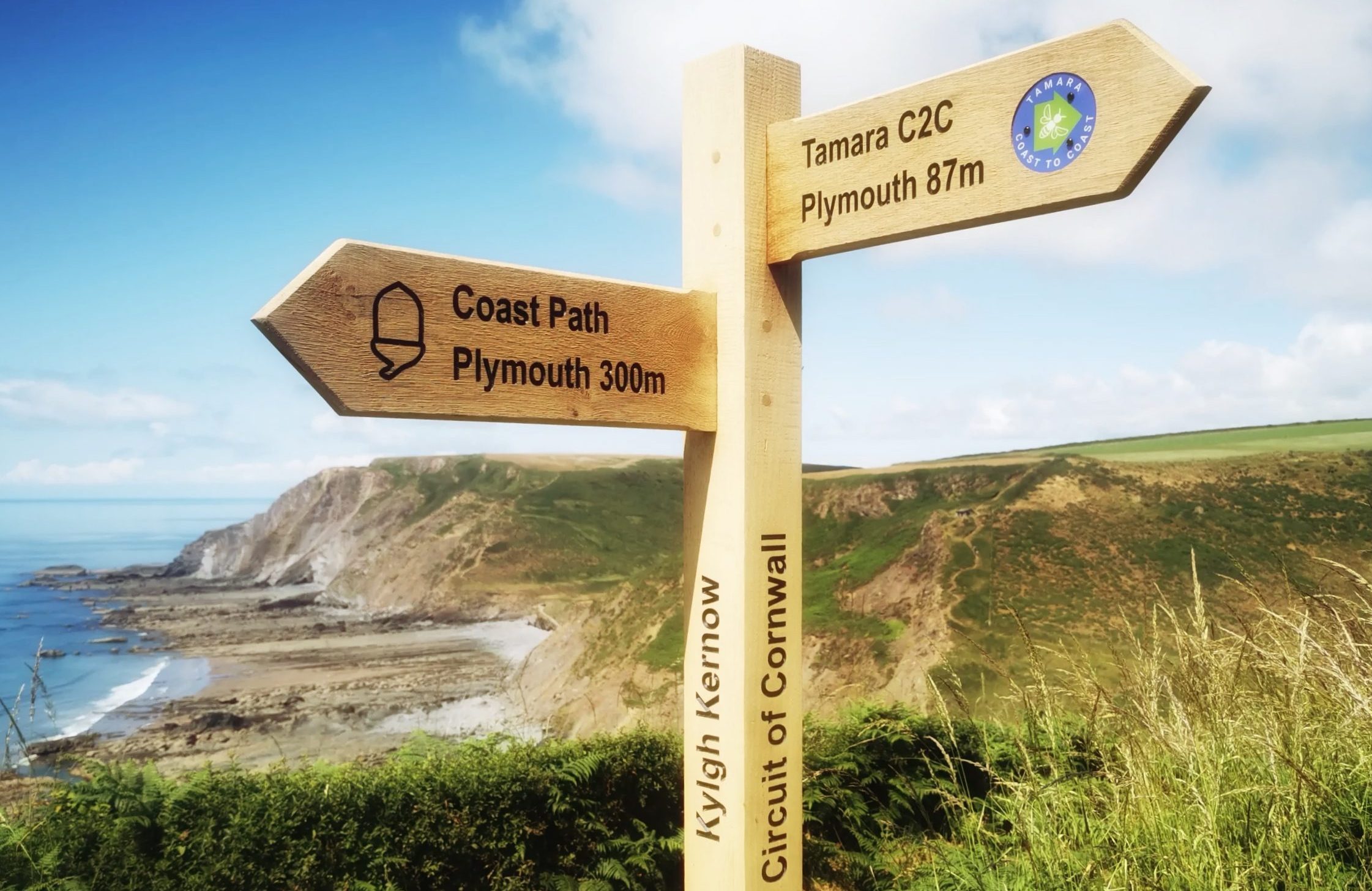
Please follow the Countryside Code whilst walking the Way
General information
What is the Tamara Coast to Coast Way?
The Tamara Coast to Coast Way is an 87-mile walking route, reaching from the South to the North Coast in Southwest England. The route joins together existing rights of way to create a path which broadly follows the River Tamar and establishes a new circular walk around the coast and county boundary of Cornwall.
The route starts at Plymouth, heads towards the source of the River Tamar on Woolley Moor and onwards for another 4 miles to the North coast at Marsland Mouth. This in conjunction with the South West Coast Path in turn creates a 388 mile walking route around the whole of Cornwall called Kylgh Kernow (Cornish for Circuit of Cornwall).
The creation of this new walking route has been led by the Tamara Landscape Partnership Scheme, funded by the National Lottery Heritage Fund. The scheme aims to create a brighter future for the Tamar Valley and its communities.
When did it open and why?
The route opened on Tuesday 11 July 2023 and runs through a beautiful area of the Devon and Cornwall countryside that is often ‘overlooked’ by visitors as they head for our coasts and moors. The Tamar Valley Discovery Trail runs from Tamerton Foliot to Launceston, but the new route will extend this at each end to create a coast-to-coast walking route broadly following the River Tamar, opening up a beautiful part of the South West to more people and helping to support the local economy. The Circuit of Cornwall will also be popular with those walkers wanting a purely ‘Cornish’ experience.
Who was involved in the development of the Tamara Coast to Coast Way?
The project was led by the Tamara Landscape Partnership Scheme funded by the National Lottery Heritage Fund, with the help of the Countryside and Rights of Way teams from Devon County, Cornwall & Plymouth City Councils.
How was it funded?
The Tamara Landscape Partnership Scheme and this project are funded by the National Lottery Heritage Fund. This project is 1 of 10 projects running as part of the Tamara Scheme. With match-funding commitments from other partners including Cornwall County Council and Devon County Council, the total to be invested across the Tamar Valley landscape until 2025 will be £3.2 million.
Who will manage the route?
The route follows existing public rights of way which will continue to be maintained by the highway authorities. Ongoing promotion and provision of information about the route will be provided by the Tamar Valley National Landscape. Note vegetation will grow quickly in summer months (walking stick can be useful).
Who was consulted as part of the project?
We consulted user groups, Visit Tamar Valley, parish councils and the local access forum (groups made up of landowners, user groups and highway authorities) who were all supportive.
Who is this route designed for – can anyone walk it?
The overall route is designed for fairly strong walkers, with the longest day covering 17 miles. However, there are options to break it into shorter sections, and the Tamar Valley National Landscape has also developed a range of downloadable circular walks that can be completed in a few hours, along with some ‘Miles without Stiles’ routes that are suitable for mobility scooters or people with a pram.
How is this benefitting the Tamar Valley?
The Tamar Valley is a protected and unspoilt landscape, and we want to keep it that way. The new route will help more people to explore this special place and to value it. We are encouraging visitors to use green transport where possible and have developed the walk and a host of other walks with the train in mind. More visitors will also in turn support local businesses and the local economy.
How many more walkers will this bring to the Valley?
We hope that the appeal of being able to follow the river Tamar from sea to source and the other new opportunities to explore the Tamar Valley on foot will attract a few hundred more staying visitors each year, particularly in the quieter ‘off-seasons’. This should help to keep the balance between encouraging more visitors, supporting local enterprises, and maintaining the beauty and tranquillity of the valley.
What are you doing to promote sustainable tourism?
The route overall follows existing paths and quite lanes, many of which are already well-used and so we envisage that the increased use resulting from us promoting them as part of a new trail, or circular walk will cause minimal impact. The route has been designed so that each end can be reached using public transport, and we encourage all our visitors to respect the countryside and follow the Countryside Code.
The Route
How did you decide upon the route?
In consultation with local walkers, the potential routes were surveyed between August and November 2019 to identify a ‘recommended route’ that extended the existing Tamar Valley Discovery Trail using existing public rights of way, permissive paths, and safe roads between the north and south coasts. Potential routes were evaluated against the following criteria:
- Runs relatively close to the River Tamar and county boundary.
- Passes through attractive scenery and visits places of historic or cultural interest.
- Passes villages and rural businesses where walkers can find accommodation and refreshments.
- Avoids hazardous road sections or crossings
We also put out the proposals to public consultation and contacted the local parish councils, landowners along new sections of the route and through the Local Access Forums, user groups in Plymouth, Devon & Cornwall.
What are the key highlights of the Tamara Way?
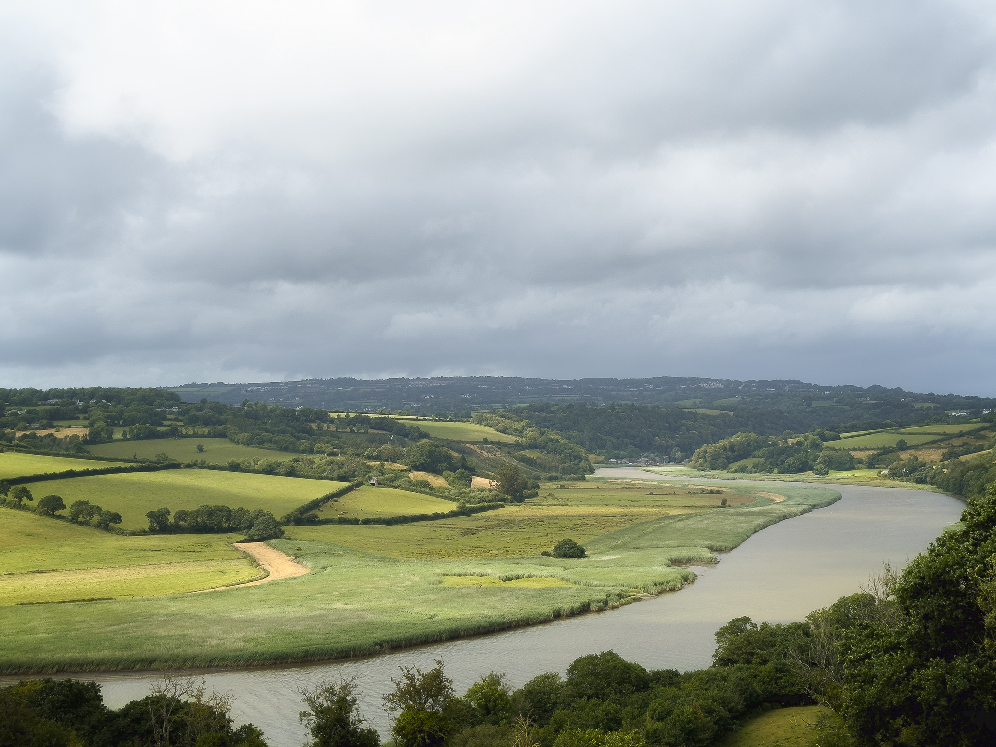
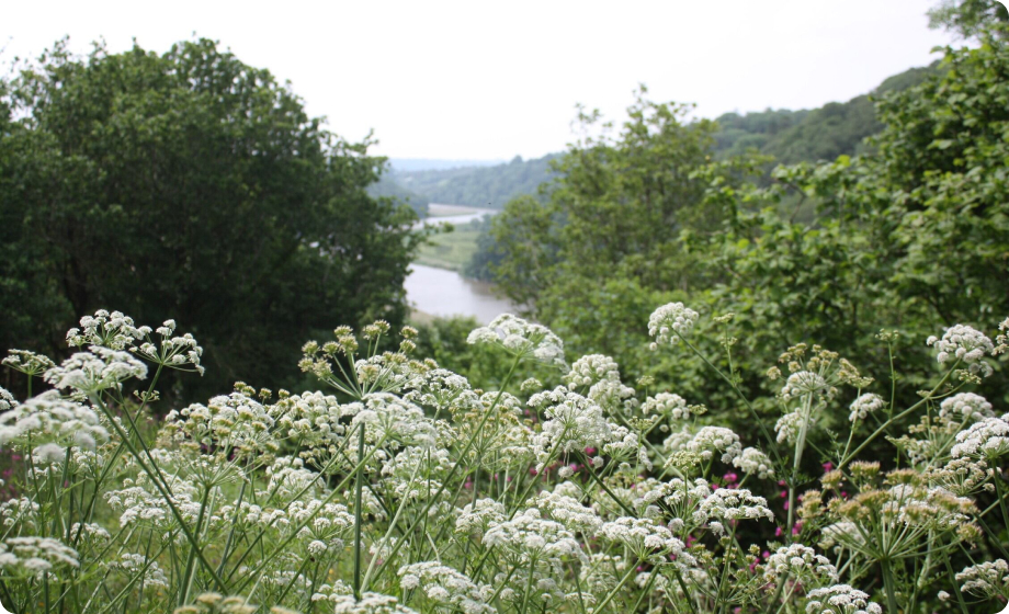
The core attractions of the route are the scenery in the Tamar Valley National Landscape, the historic features of the Cornish Mining World Heritage Site. It is also a fascinating journey along the length of the river Tamar, from its broad estuary to the trickle at its source, passing through tranquil farmland along the way. Other highlights are:
- Walking from Mount Edgcumbe alongside the estuary to Millbrook, and then through historic parts of Plymouth
- St Budeaux Church: small attractive church dating back to 1563, where Sir Francis Drake was married.
- Calstock – with its beautiful viaduct and newly created wetlands
- Gunnislake Clitters – riverside, woodland walk passing engine house, with views across to Great Consols Mine
- Visiting the attractive villages of Milton Abbot & Lifton
- Launcells Church – 14th century St Swithin’s church (described by St John Betjeman as ‘the least spoilt church in Cornwall’) and holy well.
- Walking alongside stretches of the historic Bude canal
- Dunsdon National Nature Reserve: Culm grassland, rich in wildlife, insect and birdlife managed by the Devon Wildlife Trust
- Reaching the Atlantic coast at the picturesque Marsland Mouth
How can people find out more about the Tamara Way?
More details about the Tamara Coast to Coast Way and a detailed guidebook can be found at www.tamarvalley-nl.org.uk/walking along with over 30, 1 hour to full day walks, starting in the villages and train stations in the Tamar Valley. The short walks can be downloaded onto people’s phone, or printed at home, and we’ve produced a comprehensive Tamara Coast to Coast Way guidebook which can be purchased from the website.
Can people only walk part of the Tamara Way if they want to?
Yes, particularly for the section south of Gunnislake, it is easy to walk parts of the trail and use the train and other public transport to return to their start point. We have also produced new downloadable information on over 20 short walks within the AONB.
How do you get from the Devon side at Bere Alston to Calstock by walking?
Following the OS map currently indicates that you can get across the river at Calstock. This is not currently the case (but see below). Unfortunately, a limitation of the OS map app is that you can’t have a gap in the route, and so we had to consider 2 options when it was developed:
- The route between Bere Alston station and Calstock station as a straight line (which we hope would be obvious cannot be walked), and put in the route description that this section needs to be done by train, or
- To show the route running along the railway line between the stations – which we decided against, in case people thought you could walk across the viaduct.
However, the good news is that a Tamara Landscape Partnership Scheme project will in 2024 run a 2-year trial reinstatement of the Calstock passenger ferry. This will allow walkers of the Tamara Coast to Coast Way / Tamar Valley Discovery Trail to cross the river at Calstock and avoid having to take the train from Bere Alston to Calstock when needing to cross the river. If it is commercially feasible, we hope the ferry will be maintained long-term.
How can I find the Tamara Coast to Coast Way on the OS App on my mobile?
If you have the app installed on your phone, when you click on the links at the bottom of the Tamara Coast to Coast web page, it should give you the option to open the walk in either the app or in your browser. If this doesn’t work, in the app zoom into the start of the walk (Mt Edgcumbe / Cremyll), it should appear as one of the ‘public walks’.
Is there a GPX or KML file of the whole route?
At the bottom of the Tamara Coast to Coast web page, there are links to Ordnance Survey maps of the route and, when clicked through on the left hand side toolbar, there is the option to download as a gpx file. At the moment the website only has maps for each individual section, but we also have one for the whole route – https://explore.osmaps.com/route/17742295
Where can we find information on accommodation, places to eat, local taxi companies, or other companies which might be able to pick us up and drop us off along the route?
Please look at the Visit Tamar Valley website where you will find much of this information.
Our Coast to Coast guidebook also provides some useful information on accommodation and transport options.
Can I use public transport and still walk the Tamara Way?
Yes, each end of the walk and many of the towns and villages along the Way can be reached by public transport, which includes the train. As each bus company has its own website, the best way to find travel information is to go onto Google Maps and input your start and end point and select the ‘train icon’ to bring up public transport options.
What are the ground conditions like?
The ground conditions are varied, and they can change depending on the weather. We recommend wearing good walking shoes / boots and to come prepared for all weathers.
Will I encounter livestock along the route?
The route traverses a living and working landscape so you will encounter livestock at points, so please follow the guidance in the Countryside Code.
Are dogs allowed?
Yes, dogs are allowed, but please follow guidance in the Countryside Code in relation to bringing along your furry friends.
The Guidebook
Is the Guidebook small and light enough to take on the walk and is it waterproof?
The Guidebook has been designed so that it can be taken with you and used along the route. It’s A5 in size, paperback and consists of 248 pages, but it isn’t waterproof.
Does the guidebook detail the Way in both directions?
The guidebook only describes the route walking the south-north direction. So, it’s best to rely on the OS app if walking in the north-south direction which works just fine to keep you on track. However, the guidebook also includes a huge amount of information on facilities, links to public transport, points of interest, historical and cultural information which might make your walk even more interesting – it’s a pretty good read.
How can I buy a copy of the C2C guide?
You can buy a copy of the book online here: You may also be able to buy a copy for cash at the Tamar Valley Centre while stocks last.
Access
Reporting any problems with the path
Hopefully you won’t encounter any problems with the paths along the route, as it has all been checked. However, if you do, please report them to the following relevant bodies. Many Parish or Town Councils have signed up to funded schemes for maintaining these paths as follows:
- In Devon, some Parish Councils have signed up to the Parish Paths Partnership (PPP). https://www.devon.gov.uk/prow/parish-paths-partnership-scheme/
- In Cornwall it is the Local Maintenance Partnership (LMP). https://www.cornwall.gov.uk/environment/countryside/public-rights-of-way/local-maintenance-partnership/ Check if your local PC has signed up.
If a Parish or Town Council has not signed up to one of these schemes, then in theory responsibility falls back onto the County or Unitary Council whose responsibility it is to maintain the public rights of way and other paths used by the Coast to Coast Way. In this case for issues in Devon, please report them here: https://www.devon.gov.uk/prow/, and for anything in Cornwall, please report them here: https://www.cornwall.gov.uk/environment/countryside/public-rights-of-way/ .
Is it possible to cycle the Tamara Coast to Coast Way?
No. Apart from a section in the middle that is along quiet country lanes, most of the route is along public footpaths, so cycling isn’t allowed. However, the Devon Coast to Coast cycle route is a possible alternative.
Where can I charge and park my car in Plymouth?
There is plenty of parking available in Plymouth. Whether it’s in the car parks or street parking, both will require a small fee in the city. You can find out more here: Charge and Park Plymouth
What parts of the Tamara way are suitable for wheelchair users?
Much of the Tamara C2C Way may not be suitable for wheelchairs. As an alternative, supported by Defra Access for All funding, 7 short walks across the Tamar Valley National Landscape were reviewed in early 2023 and assessed as easier access ‘Strolls and Rolls in the Tamar Valley. Although not on the Tamara C2C they do offer great views, an outdoor experience and are located widely across the Tamar Valley. The 7 routes are at:
- Churchtown Farm Nature Reserve
- Cotehele Quay to Cotehele Mill, along with Cotehele to chapel lookout
- Kit Hill
- Tavistock Canal
- Tamar Trails (with minor improvements)
- Wacker Quay to Antony village (with additional seating)
- Calstock to the Calstock wetlands (with future access improvements)
The following routes have been specifically assessed for wheelchair access:
- Churchtown Farm Nature Reserve – Lynher View Walk, https://www.cornwallwildlifetrust.org.uk/nature-reserves/churchtown-farm
- Cotehele Quay to Cotehele Mill
- Kit Hill
- Tavistock Canal
Downloadable PDFs of all 7 routes detailing access information such as terrain, altitude, nearby parking and facilities will be published shortly on this website.
ebulletins
The Tamar Valley National Landscape team (hosted by Cornwall Cornwall) is committed to gathering and processing personal data with full regard for the General Data Protection Regulation (GDPR). Please view our Privacy Statement for further information here. A copy of MailChimp’s Privacy Policy can also be viewed here.