West Down & Double Waters

Moderate
3 miles (4.7km)
1½ hours
PDF download of walk PDF download of walk

Enjoy far-reaching views, beautiful oak woodland, industrial archaeology and a sparkling moorland river on this 3-mile stroll to the spot where rivers Walkam and Tavy meet.


Double Waters, where the River Walkham joins the Tavy, is one of the most special spots in West Devon – and can only be accessed on foot. One way is to follow the Walkham downstream from the parking area at Grenofen Bridge; the other, described here, starts high up on West Down, enjoying stunning views over both Walkham and Tavy valleys.

The walk then heads upstream through delightful sessile oak woodland, passing the remains of old mineworkings. A steady climb up through the trees regains West Down and the start point.

Key facts

Start/Finish West Down SX 479709, PL19 9EQ

Moderate
3 miles (4.7km)
1½ hours
Parking area on West Down (free), at end of Brook Lane
None on route

Terrain

Good tracks and wooded riverside path, rough in places; steady ascent out of the Walkham valley

Public Transport

None available

Dogs

Under control at all times; livestock (ponies) on West Down

Step Image

Directions

Step 1

SX 479709

From the parking area follow the bridlepath track ahead, descending across bracken-covered slopes, dotted with hawthorn trees.

The steep-sided wooded valley ahead is that of the River Walkham; the Tavy valley is over to the right. Morewelldown Plantation, also visible to the right, crowns the hill through which the early 19th-century Tavistock Canal tunnels its way to Morwellham Quay on the River Tavy.

The track drops into light woodland, passing the summit rock of West Down Crags, to reach a path junction.

Step 2

SX 477700

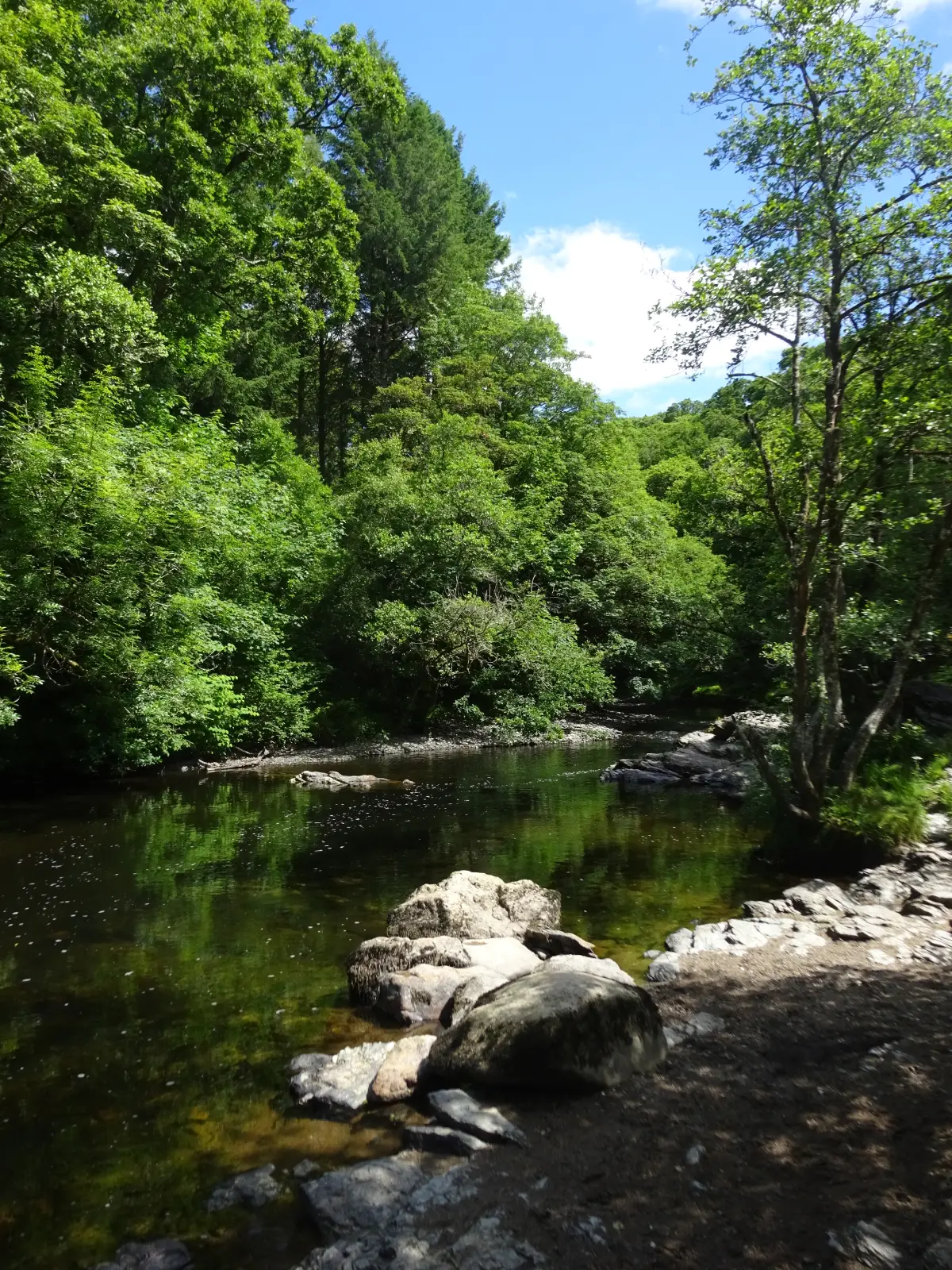
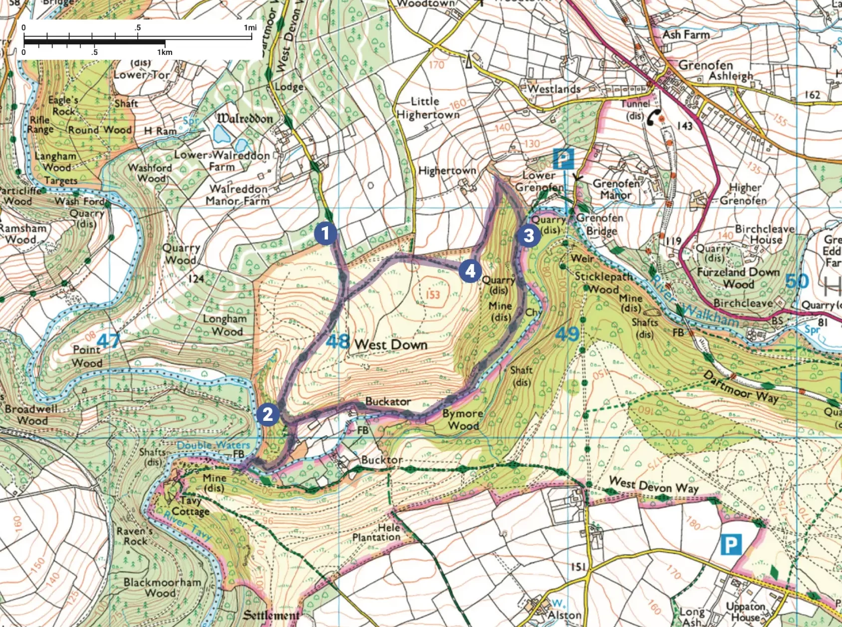
The Dartmoor Way bears left, but for Double Waters turn right on a bridlepath track that zigzags steeply downhill to reach the river. Head downstream, passing under lofty oak trees, towards the confluence of the two rivers. On reaching an island bear right and ascend between the two stacks of Goat Rock, to reach Double Waters (near a footbridge over the Walkham).

Just below the confluence, on the Devon side of the valley, lie the remains of the Virtuous Lady Mine, an initially profitable copper mine which operated from at least 1724 until final closure in 1879.

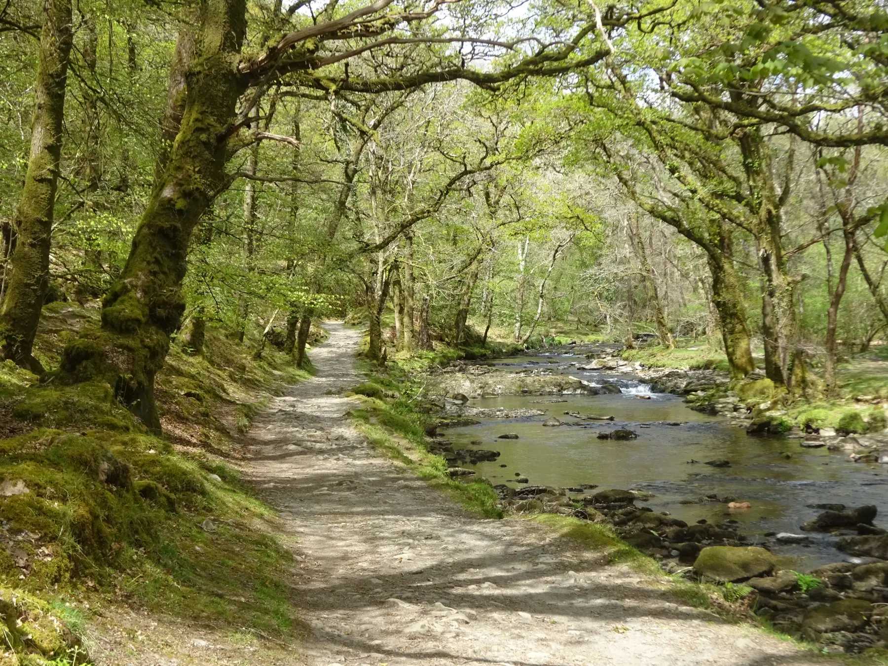
Retrace your steps to the bridlepath junction and turn right, signed to Buckator. On reaching a parking area beyond a house bear right, down to the river, then follow the rough and rooty riverside path upstream. The river is beautiful here, cutting a rocky way through the valley via waterfalls and deep pools.

Pass below the monumental outcrop of non-granite Raven Rock, which towers above the path. Look out for remnants of walls and industrial buildings – including the calciner or ‘burning house’ – and eventually pass the old engine shaft chimney stack of West Down Mine, a failed tin and copper mine which operated for 10 years from 1847.

The hummocks near the river, formed of water-smoothed pebbles, are evidence of tin streaming. A massive retaining wall alongside the path marks the boundary of Lower Grenofen elvan quarry, which produced kerbstone for London streets in Victorian times.

Elvan is quite rare, and a ‘soft’ stone, popular with sculptors because it can be finely carved.

Step 3

SX 488709

Reach a bridlepath junction (the Dartmoor Way goes straight on) and turn left (there are two paths, which soon join up) and start the steep ascent out of the valley.

At the next bridlepath post turn left and head along the top edge of the wood, below a hedgebank. The path levels and emerges into the open ground of West Down to reach a fork by a hedgebank corner.

Step 4

SX 486708

Keep straight on, parallel to the hedgebank, along a broad grassy way. Wide paths have been cut through the bracken across West Down to encourage the spread of violets, the larval food of the rare high brown fritillary butterfly; much of the walk is within a Site of Special Scientific Interest (SSSI), designated for its unusual wildlife.

At the next hedgebank corner, and a junction of paths, keep straight on over the crest of the hill – look back for panoramic views of the distant Dartmoor tors. Descend gently and cross another grassy way, heading towards trees. At the next corner turn right to reach the parking area.

Step